


Remer Voting District, Cass County, Minnesota
About
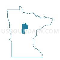
Outline

Summary
| Unique Area Identifier | 601405 |
| Name | Remer Voting District |
| County | Cass County |
| State | Minnesota |
| Area (square miles) | 1.38 |
| Land Area (square miles) | 1.38 |
| Water Area (square miles) | 0.00 |
| % of Land Area | 100.00 |
| % of Water Area | 0.00 |
| Latitude of the Internal Point | 47.05687010 |
| Longtitude of the Internal Point | -93.91242290 |
Maps


Graphs
Select a template below for downloading or customizing gragh for Remer Voting District, Cass County, Minnesota


Neighbors
Neighoring Voting District (by Name) Neighboring Voting District on the Map
- Lima Twp. Voting District, Cass County, MN
- Remer Twp. Voting District, Cass County, MN
- Slater Twp. Voting District, Cass County, MN
- Willow River Voting District, Cass County, MN
Top 10 Neighboring County Subdivision (by Population) Neighboring County Subdivision on the Map
- Remer city, Cass County, MN (370)
- Slater township, Cass County, MN (215)
- Remer township, Cass County, MN (189)
- Lima township, Cass County, MN (101)
- East Cass UT, Cass County, MN (62)